Plaquemines Parish Coastal Erosion
About the Area
Nearly 15 miles south of New Orleans, LA begins the northernmost parts of Plaquemines Parish, an 845 square mile area beginning and ending with the currents of the mighty Mississippi River. As you travel farther and farther south, the urban communities of Belle Chasse gradually meld into the more rural, agricultural areas of Port Sulphur, Empire, Buras, and Venice. Prior to Hurricane Katrina in 2005, this area was home to approximately 28,000, but since then has dropped to nearly 22,000 residents. Much history presides over Plaquemines, from the Woodland Plantation built in the 1830's and pictured on the Southern Comfort whiskey bottle nationwide to the historical Fort Jackson built in 1822 during the Battle of New Orleans. The saltwater marshes and estuaries make for one of the best commercial and sportsman fishing, as well as hunting, areas in the world. Not to mention the enormous natural gas and oil industry that preoccupies this area.
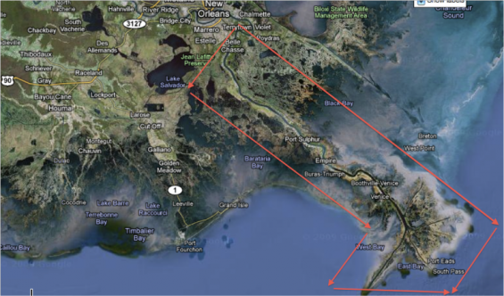
Google Earth satellite image of the Plaquemines Parish area enclosed in red
Google Earth satellite image of the Plaquemines Parish area enclosed in red
But a sad reality faces this region. The once plentiful marshes and bayous of this area are disappearing at an exponential rate, and affecting the livelihood of the very people who depend on this fragile ecosystem. Not a recurring thought to most, but for the residents of Plaquemines this desperate situation daily threatens not only their home, but also their way of life. Perhaps our nation needs to be reminded of this dire need for interference and help. The following pages give first hand accounts to the frustration, anxiety, desperation, hopelessness, and in some cases hopefulness of the heartbreaking situation they must endure.
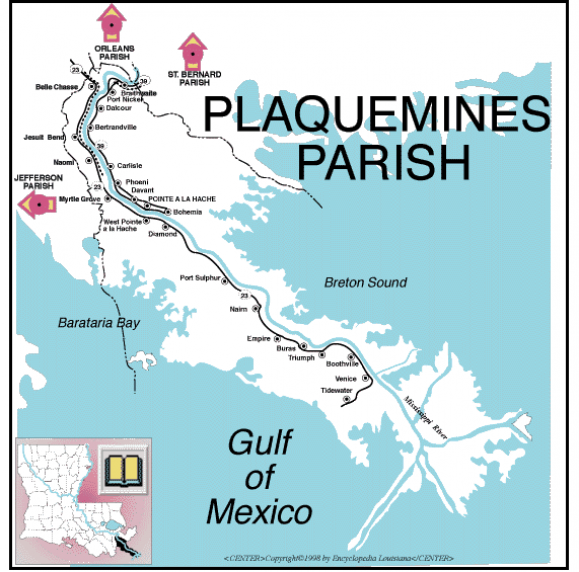
The subset shows the location of Plaquemines in relation to the entire state of Louisiana. The map clearly shows the various cities that make up Plaquemines Parish as well as the Gulf of Mexico and the Mississippi River
The subset shows the location of Plaquemines in relation to the entire state of Louisiana. The map clearly shows the various cities that make up Plaquemines Parish as well as the Gulf of Mexico and the Mississippi River
